Loading...
Loading map...2023 Map of Milledgeville
USGS Topo · Published 2023About this map
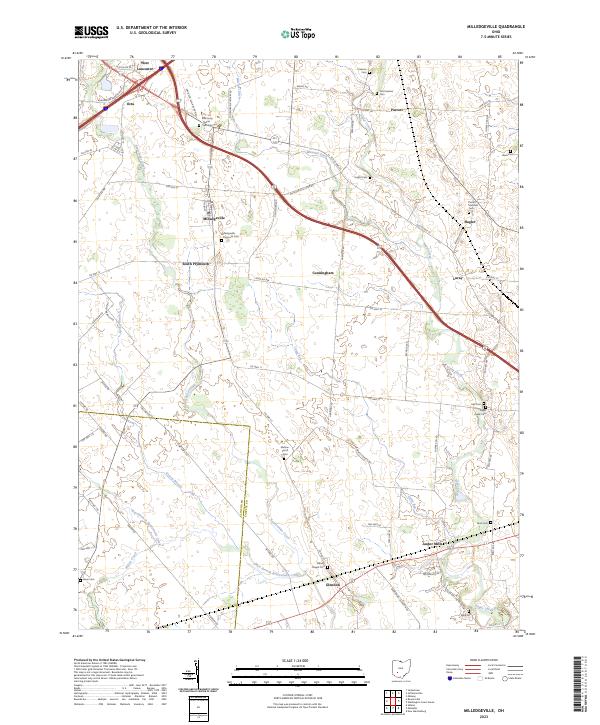
Milledgeville and the surrounding agricultural lands of Fayette County are defined by a network of drainage systems and long-established rural settlements. The terrain is marked by the winding course of Rattlesnake Creek and its tributaries, such as Grassy Branch and Wilson Creek, which transition into man-made improvements like the Missouri Ditch. These waterways historically dictated the placement of small community hubs including South Plymouth, Octa, and Cunningham.
Find a feature on this map
79 named features on this map. Tap any name to fly to it.
Don’t see what you’re looking for? This feature index may not catch every label — zoom into the map to look around manually.
Map Details
Date Portrayed2023
Date Published2023
PublisherU.S. Geological Survey
Map TypeTopographic
Scale1:24000
Physical Dimensions24 x 29 inches
Editions of this 2023 Milledgeville Map
This is the sole edition of this map. No revisions or reprints were ever made.
Historical Maps of Jasper Mills Through Time
Featured Locations
Source Details
SourceU.S. Geological Survey
CopyrightPublic Domain