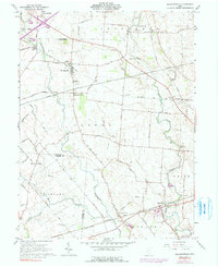
1961 Map of Milledgeville
USGS Topo · Published 1991About this map
Rattlesnake Creek and Sugar Creek carve through this agricultural landscape in Fayette and Clinton counties, where small village centers and crossroads anchor a grid of rural township roads. The settlement of Milledgeville serves as a focal point, supported by the Baltimore and Ohio railroad line cutting diagonally across the terrain. This 1961 survey, later updated with mid-1970s revisions, illustrates a region defined by its family-named cemeteries and rural institutions, such as Spring Grove Ch and the Township Sch.
Find a feature on this map
63 named features on this map. Tap any name to fly to it.
Don’t see what you’re looking for? This feature index may not catch every label — zoom into the map to look around manually.
Map Details
Editions of this 1961 Milledgeville Map
Other maps of this area

1906 · Mt Sterling
USGS Topo · 1:62,500

1916 · Octa
USGS Topo · 1:62,500

1917 · Greenfield
USGS Topo · 1:62,500

1917 · Sabina
USGS Topo · 1:62,500

1943 · Sabina
USGS Topo · 1:62,500

1944 · Greenfield
USGS Topo · 1:62,500

1944 · Octa
USGS Topo · 1:62,500

1947 · Columbus
USGS Topo · 1:250,000
1960 · New Martinsburg
USGS Topo · 1:24,000

1961 · Columbus
USGS Topo · 1:250,000