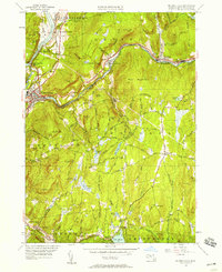
1948 Map of Millers Falls
USGS Topo · Published 1958About this map
Millers River and the Connecticut River define the industrial and transit corridors of this Franklin County landscape, where the Central Vermont Railway and Boston and Maine Railroad converge near the village of Millers Falls. The 1948 revision captures the area at a peak of rail and roadway connectivity, featuring the iconic Mohawk Trail winding through Erving toward Stoneville. While the river valleys hum with transport, the surrounding uplands like Northfield Mountain and Bear Mountain remain dotted with small rural landmarks, including the Northfield Farms Sch and various family-named burying grounds such as Gardner Cem.
Find a feature on this map
107 named features on this map. Tap any name to fly to it.
Don’t see what you’re looking for? This feature index may not catch every label — zoom into the map to look around manually.
Map Details
Editions of this 1948 Millers Falls Map
This is the sole edition of this map. No revisions or reprints were ever made.
Other maps of this area

1885 · Northampton
USGS Topo · 1:62,500

1886 · Northampton
USGS Topo · 1:62,500

1887 · Warwick
USGS Topo · 1:62,500

1887 · Belchertown
USGS Topo · 1:62,500

1889 · Warwick
USGS Topo · 1:62,500

1890 · Belchertown
USGS Topo · 1:62,500

1890 · Greenfield
USGS Topo · 1:62,500

1891 · Northampton
USGS Topo · 1:62,500

1893 · Northampton
USGS Topo · 1:62,500

1893 · Belchertown
USGS Topo · 1:62,500