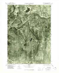
1975 Map of Millers Falls
USGS Topo · Published 1981About this map
The Connecticut River and its major tributary, the Millers River, define the topographical character of this western Massachusetts region during the mid-1970s. This orthophotograph, derived from high-altitude aerial imagery, captures the dense woodland and river-valley settlements of Franklin County in sharp relief. The village of Millers Falls serves as a focal point where the waters converge, while smaller communities like Farley and Erving follow the tight corridor carved by the winding Millers River to the east. Further south, the landscape transitions into the quieter reaches of Wendell, North Leverett, and Locks Village. The contrast between the cleared residential and industrial pockets along the water and the heavily forested interior reveals the enduring settlement patterns established by the region's early milling and transit history.
Find a feature on this map
8 named features on this map. Tap any name to fly to it.
Don’t see what you’re looking for? This feature index may not catch every label — zoom into the map to look around manually.
Map Details
Editions of this 1975 Millers Falls Map
This is the sole edition of this map. No revisions or reprints were ever made.
Other maps of this area

1885 · Northampton
USGS Topo · 1:62,500

1886 · Northampton
USGS Topo · 1:62,500

1887 · Warwick
USGS Topo · 1:62,500

1887 · Belchertown
USGS Topo · 1:62,500

1889 · Warwick
USGS Topo · 1:62,500

1890 · Belchertown
USGS Topo · 1:62,500

1890 · Greenfield
USGS Topo · 1:62,500

1891 · Northampton
USGS Topo · 1:62,500

1893 · Northampton
USGS Topo · 1:62,500

1893 · Belchertown
USGS Topo · 1:62,500