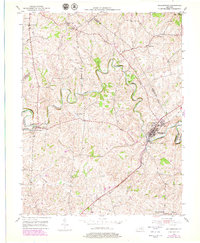
1953 Map of Millersburg
USGS Topo · Published 1979About this map
Millersburg anchors the eastern edge of this landscape, where the Millersburg Military Institute stands prominently near the junction of major travel corridors. The winding path of Hinkston Creek dominates the central topography, its serpentine meanders carving through the hills before meeting the South Fork Licking River near Ruddels Mills. This 1950s survey captures the region's agricultural character, defined by small rural hubs and historical institutions. The presence of the County Infirmary and the County School near Millersburg reflects the local infrastructure of the era, while the Louisville and Nashville railroad provides a vital industrial link. Genealogists may find value in the specific locations of the Old Haton Cem and Old East Broadwell Cem, along with scattered settlements like Hooktown and Colville that populate the tri-county border area of Bourbon, Nicholas, and Harrison.
Find a feature on this map
29 named features on this map. Tap any name to fly to it.
Don’t see what you’re looking for? This feature index may not catch every label — zoom into the map to look around manually.
Map Details
Editions of this 1953 Millersburg Map
2 editions found
Other maps of this area

1927 · Lexington
USGS Topo · 1:48,000

1929 · Cynthiana
USGS Topo · 1:48,000

1929 · Lexington
USGS Topo · 1:62,500

1934 · Cynthiana
USGS Topo · 1:62,500

1952 · Paris East
USGS Topo · 1:24,000

1952 · North Middletown
USGS Topo · 1:24,000

1952 · Piqua
USGS Topo · 1:24,000

1952 · Shady Nook
USGS Topo · 1:24,000

1953 · Carlisle
USGS Topo · 1:24,000

1953 · Millersburg
USGS Topo · 1:24,000