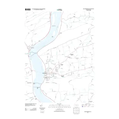
2013 Map of Millersburg
USGS Topo · Published 2013About this map
The Susquehanna River dominates this landscape, carving through the Susquehanna Water Gaps and sheltering large landmasses like Sweigarts Island and Crafts Island. Along its eastern bank, the grid of Millersburg and adjacent Lenkerville serves as a primary hub of settlement, where the convergence of Shippens Run, Little Wiconisco Cr, and the larger Wiconisco Cr shapes the local topography.
Find a feature on this map
174 named features on this map. Tap any name to fly to it.
Don’t see what you’re looking for? This feature index may not catch every label — zoom into the map to look around manually.
Map Details
Editions of this 2013 Millersburg Map
This is the sole edition of this map. No revisions or reprints were ever made.
Other maps of this area

1892 · Harrisburg
USGS Topo · 1:62,500

1893 · Millersburg
USGS Topo · 1:62,500

1899 · Harrisburg
USGS Topo · 1:62,500

1907 · New Bloomfield
USGS Topo · 1:62,500

1907 · Millerstown
USGS Topo · 1:62,500

1924 · Harrisburg
USGS Topo · 1:62,500

1943 · Millerstown
USGS Topo · 1:62,500

1943 · Millersburg
USGS Topo · 1:62,500

1943 · Harrisburg
USGS Topo · 1:62,500

1943 · New Bloomfield
USGS Topo · 1:62,500
Featured Places
- Malta, Lower Mahanoy Township
- Lenkerville, Upper Paxton Township
- Fisherville, Jackson Township
- Killinger, Upper Paxton Township
- Rife, Upper Paxton Township