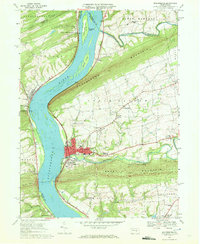
1969 Map of Millersburg
USGS Topo · Published 1972About this map
Millersburg sits at the heart of this Pennsylvania river landscape, where the Wiconisco Creek meets the broad Susquehanna River. The map captures the region's transport evolution, showing the Penn Central railroad following the riverbanks while a historic Ferry still crosses the water to the west. Broad ridges like Mahantango Mountain and Berry Mountain frame the agricultural valleys of Upper Paxton and Halifax, where small settlements such as Killinger and Rife are centered around country churches like Salem Ch and Zion Ch. The presence of several islands, including Sweigarts Island and Crafts Island, illustrates the complex braided nature of the Susquehanna in this reach. Local landmarks, from the Covered Bridge on the Wiconisco to the Oak Hill Cem above the borough, provide a detailed record of the mid-century community footprint.
Find a feature on this map
66 named features on this map. Tap any name to fly to it.
Don’t see what you’re looking for? This feature index may not catch every label — zoom into the map to look around manually.
Map Details
Editions of this 1969 Millersburg Map
4 editions found
Other maps of this area

1892 · Harrisburg
USGS Topo · 1:62,500

1893 · Millersburg
USGS Topo · 1:62,500

1899 · Harrisburg
USGS Topo · 1:62,500

1907 · New Bloomfield
USGS Topo · 1:62,500

1907 · Millerstown
USGS Topo · 1:62,500

1924 · Harrisburg
USGS Topo · 1:62,500

1943 · Millerstown
USGS Topo · 1:62,500

1943 · Millersburg
USGS Topo · 1:62,500

1943 · Harrisburg
USGS Topo · 1:62,500

1943 · New Bloomfield
USGS Topo · 1:62,500
Featured Places
- Jackson Township, PA
- Mifflin Township, PA
- Liverpool, PA
- Paxton, Upper Paxton Township
- Cloverly Acres, Upper Paxton Township