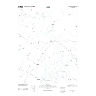
2013 Map of Millerstown
USGS Topo · Published 2013About this map
The Nolin River winds through this rural Kentucky landscape, dictating the placement of settlements and river-dependent sites like Wheelers Mill and Broad Ford. The area around Millerstown is defined by its deep historical roots, evidenced by numerous family and community burial grounds such as Carbytown Cem and the Copelin Cemetery. The geography is marked by distinctive terrain features including Bush Bend, Joyce Island, and the elevated Buzzard Ridge. Local navigation follows a network of named hollows and ridges, from Copelin Valley to Akers Valley, where small crossroads like Spurrier and Lone Oak served as central points for the surrounding agricultural community. The map reveals a high density of small-scale water features like Sinking Fork and Slab Camp Cr, illustrating the complex drainage patterns of the region.
Find a feature on this map
85 named features on this map. Tap any name to fly to it.
Don’t see what you’re looking for? This feature index may not catch every label — zoom into the map to look around manually.
Map Details
Editions of this 2013 Millerstown Map
This is the sole edition of this map. No revisions or reprints were ever made.
Other maps of this area

1925 · Cub Run
USGS Topo · 1:62,500

1932 · Big Clifty
USGS Topo · 1:62,500

1934 · Munfordville
USGS Topo · 1:48,000

1935 · Elizabethtown
USGS Topo · 1:48,000

1937 · Munfordville
USGS Topo · 1:62,500

1938 · Elizabethtown
USGS Topo · 1:62,500

1949 · Sonora
USGS Topo · 1:24,000

1949 · Summit
USGS Topo · 1:24,000

1949 · Big Clifty
USGS Topo · 1:24,000

1949 · Big Clifty
USGS Topo · 1:62,500