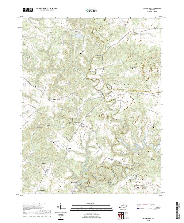
2022 Map of Millerstown
USGS Topo · Published 2022About this map
The Nolin River carves a deep, winding path through the borderlands of Grayson, Hardin, and Hart Counties, creating a landscape defined by sharp river bends and dramatic terrain like Bush Bend and Joyce Island. This modern survey reveals a rural network of high ridges and hollows, where family history is anchored by numerous cemeteries such as Carbytown Cem and Phillips Cem. Small settlements like Millerstown and Spurrier are connected by narrow winding roads like Flint Hill Rd and Spurrier Rd, tracing the high ground above the river valley.
Find a feature on this map
115 named features on this map. Tap any name to fly to it.
Don’t see what you’re looking for? This feature index may not catch every label — zoom into the map to look around manually.
Map Details
Editions of this 2022 Millerstown Map
This is the sole edition of this map. No revisions or reprints were ever made.
Other maps of this area

1925 · Cub Run
USGS Topo · 1:62,500

1932 · Big Clifty
USGS Topo · 1:62,500

1934 · Munfordville
USGS Topo · 1:48,000

1935 · Elizabethtown
USGS Topo · 1:48,000

1937 · Munfordville
USGS Topo · 1:62,500

1938 · Elizabethtown
USGS Topo · 1:62,500

1949 · Sonora
USGS Topo · 1:24,000

1949 · Summit
USGS Topo · 1:24,000

1949 · Big Clifty
USGS Topo · 1:24,000

1949 · Big Clifty
USGS Topo · 1:62,500