2021 Map of Millersville
USGS Topo · Published 2021About this map
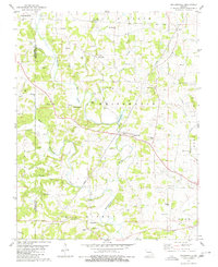
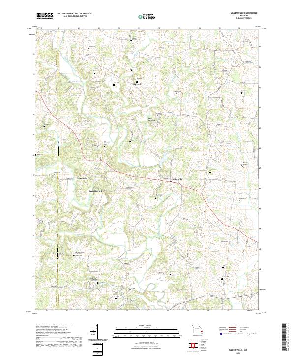
Millersville and Kurreville serve as the primary nodes of activity in this rural landscape along the border of Bollinger and Cape Girardeau counties. The terrain is deeply defined by the winding course of Upper Whitewater Creek and its many tributaries, including Caney Fork and Sandy Br. Significant for genealogists, the map identifies dozens of family-named burial grounds like the Old Niswonger Cem, Gladish Cem, and Slinkerd Cem, reflecting generations of local settlement. Historical crossings such as Hartle Ford and Reynolds Ford indicate where early travel routes once navigated the waterways. Distinctive geological features like Devils Backbone and Cave Hill punctuate the topography, while the Fairview United Methodist Church Cem and Haynes Chapel Congregational Church Cem mark the community's spiritual centers. This modern survey captures the enduring rural character of the region, from the Prince Airport to the quiet reaches of Cedar Lake.
Find a feature on this map
67 named features on this map. Tap any name to fly to it.
Don’t see what you’re looking for? This feature index may not catch every label — zoom into the map to look around manually.
Map Details
Editions of this 2021 Millersville Map
This is the sole edition of this map. No revisions or reprints were ever made.