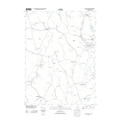
2013 Map of Millerton
USGS Topo · Published 2013About this map
Millerton serves as a central hub in this survey of the border region where New York and Connecticut meet. The landscape is defined by a series of small, scattered settlements such as Irondale, Spencer Corners, and Northeast Center, which are linked by a network of rural roads traversing the valleys between Winchell Mountain and Silver Mountain. To the south, the influence of former rail corridors is evident in the naming of Sharon Station and Coleman Station, markers of a time when these points were vital for moving agricultural goods from the surrounding valley farms.
Find a feature on this map
112 named features on this map. Tap any name to fly to it.
Don’t see what you’re looking for? This feature index may not catch every label — zoom into the map to look around manually.
Map Details
Editions of this 2013 Millerton Map
This is the sole edition of this map. No revisions or reprints were ever made.
Other maps of this area

1885 · Sheffield
USGS Topo · 1:62,500

1888 · Sheffield
USGS Topo · 1:62,500

1891 · Sheffield
USGS Topo · 1:62,500

1892 · Cornwall
USGS Topo · 1:62,500

1893 · Sheffield
USGS Topo · 1:62,500

1893 · Cornwall
USGS Topo · 1:62,500

1897 · Sheffield
USGS Topo · 1:62,500

1899 · Housatonic
USGS Topo · 1:125,000

1899 · Millbrook
USGS Topo · 1:62,500

1900 · Housatonic
USGS Topo · 1:125,000