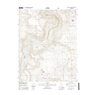
2015 Map of Millerton Lake East
USGS Topo · Published 2015About this map
The San Joaquin River carves through the transition between Madera and Fresno counties, creating a landscape of high mesas and deep valleys. The southwest corner is dominated by the waters of Millerton Lake, while the northeastern reaches climb into the Sierra National Forest. This terrain is defined by flat-topped landmarks like Table Mtn, Kennedy Table, and Marshall Hill, which oversee a network of foothill settlements. Local hubs such as Marshall Junction, Prather, and Welbarn are connected by Auberry Rd, serving the residential and agricultural needs of the Auberry Valley. Recreational routes like the San Joaquin River Trail and Pa'san Ridge Trail follow the river's path, while family-oriented sites such as the Auberry Cemetery provide deep roots for local genealogical research in this part of the Sierra Nevada foothills.
Find a feature on this map
62 named features on this map. Tap any name to fly to it.
Don’t see what you’re looking for? This feature index may not catch every label — zoom into the map to look around manually.
Map Details
Editions of this 2015 Millerton Lake East Map
This is the sole edition of this map. No revisions or reprints were ever made.
Other maps of this area

1904 · Kaiser
USGS Topo · 1:125,000

1912 · Mariposa
USGS Topo · 1:125,000

1916 · Sulphur Springs
USGS Topo · 1:24,000

1919 · Sulphur Springs
USGS Topo · 1:31,680

1922 · Trimmer
USGS Topo · 1:96,000

1922 · Friant
USGS Topo · 1:31,680

1923 · Academy
USGS Topo · 1:31,680

1924 · Dinuba
USGS Topo · 1:125,000

1942 · Watts Valley
USGS Topo · 1:62,500

1942 · Millerton Lake
USGS Topo · 1:62,500