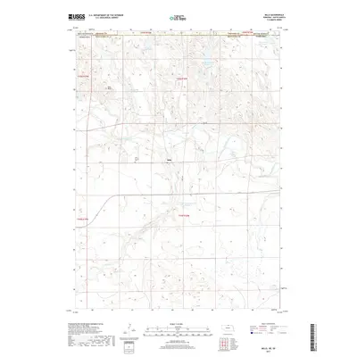
2017 Map of Mills
USGS Topo · Published 2017About this map
The Keya Paha River winds through this rural landscape on the Nebraska-South Dakota border, anchoring a community defined by its remote water resources and small-scale settlement. At the heart of the sheet lies Mills, a tiny community connected by the junction of Trail Rd and Mills Rd. The surrounding countryside is dotted with numerous managed water bodies, including Kaupp East Reservoir, Peterson Reservoir Number 2, and Rowan Reservoir, which illustrate the importance of irrigation and water storage in this high-plains environment. Local history and genealogy are anchored at the Olive Branch Cem near the riverbanks. The terrain is marked by distinctive elevations such as Nets Peak, providing topographical relief among the drainage networks of Coon Cr, Spring Cr, and Shingle Cr. This survey captures the enduring rural character of Keya Paha County in the early twenty-first century.
Find a feature on this map
27 named features on this map. Tap any name to fly to it.
Don’t see what you’re looking for? This feature index may not catch every label — zoom into the map to look around manually.
Map Details
Editions of this 2017 Mills Map
This is the sole edition of this map. No revisions or reprints were ever made.
Other maps of this area

1949 · Jamison SW
USGS Topo · 1:24,000

1950 · Mariaville
USGS Topo · 1:24,000

1951 · Jamison SW
USGS Topo · 1:24,000

1955 · Mitchell
USGS Topo · 1:250,000

1955 · O'Neill
USGS Topo · 1:250,000

1959 · O'Neill
USGS Topo · 1:250,000

1959 · Mitchell
USGS Topo · 1:250,000

1964 · Gregory SE
USGS Topo · 1:24,000

1964 · Mills
USGS Topo · 1:24,000

1964 · Paxton
USGS Topo · 1:24,000