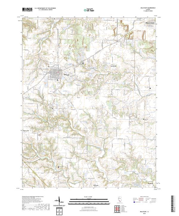
2024 Map of Millstadt
USGS Topo · Published 2024About this map
Millstadt serves as a central hub in this section of St. Clair County, where agricultural fields meet expanding residential clusters south of Belleville. The landscape is defined by the winding paths of Prairie du Pont Creek and Douglas Creek, which feed a series of local water bodies including Bell Lake Number 1 and Roachtown Lake. For genealogists, the map is particularly rich in family and community burial sites, from the centrally located Mount Evergreen Cem to the outlying Stein - Nagel Cem and High Prairie Cem.
Find a feature on this map
134 named features on this map. Tap any name to fly to it.
Don’t see what you’re looking for? This feature index may not catch every label — zoom into the map to look around manually.
Map Details
Editions of this 2024 Millstadt Map
This is the sole edition of this map. No revisions or reprints were ever made.
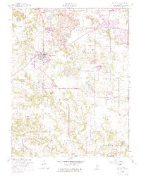
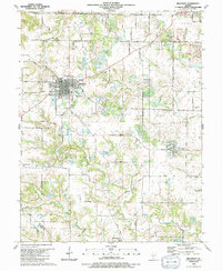
Historical Maps of Roachtown Through Time
3 maps found