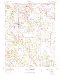
1954 Map of Millstadt
USGS Topo · Published 1975About this map
Millstadt and its surrounding agricultural and industrial landscape are documented here during a period of transition in St. Clair County. The village center is clearly defined by its street grid, while the outlying areas of Stookey and Smithton townships reveal a heavy reliance on extraction, marked by numerous Strip Mine operations and the Settling Basin. These industrial scars sit alongside established community anchors such as Stookey Sch, Concordia Ch, and several well-placed burial grounds including Mt Evergreen Cem and St James Cem.
Find a feature on this map
29 named features on this map. Tap any name to fly to it.
Don’t see what you’re looking for? This feature index may not catch every label — zoom into the map to look around manually.
Map Details
Editions of this 1954 Millstadt Map
3 editions found
Other maps of this area

1888 · St. Louis
USGS Topo · 1:62,500

1907 · Belleville
USGS Topo · 1:62,500

1910 · Waterloo
USGS Topo · 1:62,500

1912 · New Athens
USGS Topo · 1:62,500

1913 · Waterloo
USGS Topo · 1:62,500

1931 · French Village
USGS Topo · 1:24,000

1933 · Cahokia
USGS Topo · 1:24,000

1934 · Cahokia
USGS Topo · 1:24,000

1935 · French Village
USGS Topo · 1:24,000

1937 · O'Fallon
USGS Topo · 1:24,000