
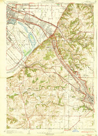
1935 Map of French Village
USGS Topo · Published 1935About this map
Industrial corridors and rural townships intersect at the bluffs east of East St Louis in this mid-1930s survey. The landscape is defined by an intricate network of competing rail lines, including the Louisville and Nashville Railroad and the St Louis and Belleville Electric Railway, which served the coal mines and clay pits scattered throughout Caseyville and Stookey. The map reveals the expansion of local institutions, from the grounds of St Henry College and Notre Dame to the sporting greens of the St Clair Country Club.
Find a feature on this map
77 named features on this map. Tap any name to fly to it.
Don’t see what you’re looking for? This feature index may not catch every label — zoom into the map to look around manually.
Map Details
Editions of this 1935 French Village Map
2 editions found
Other maps of this area

1888 · St. Louis
USGS Topo · 1:62,500

1907 · Belleville
USGS Topo · 1:62,500

1910 · Waterloo
USGS Topo · 1:62,500

1912 · New Athens
USGS Topo · 1:62,500

1913 · Waterloo
USGS Topo · 1:62,500

1931 · French Village
USGS Topo · 1:24,000

1933 · Granite City
USGS Topo · 1:24,000

1933 · Cahokia
USGS Topo · 1:24,000

1934 · Cahokia
USGS Topo · 1:24,000

1935 · Granite City
USGS Topo · 1:24,000