
1933 Map of Cahokia
USGS Topo · Published 1933About this map
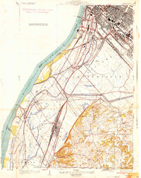
The St Louis Barracks US Army Depot and US Marine Hospital anchor this 1930s riverfront survey, illustrating the dense civic and military infrastructure along the western bank of the Mississippi River. The urban landscape is meticulously detailed, showing a tightly packed grid of residential neighborhoods like Concordia Place and Carondelet, interspersed with dozens of neighborhood institutions including St Anthony Ch and McKinley High Sch. This era captures a city deeply connected to its waterfront, with the Sidney St Ferry and the Municipal Bridge providing vital links across the state line between Missouri and Illinois.
Find a feature on this map
33 named features on this map. Tap any name to fly to it.
Don’t see what you’re looking for? This feature index may not catch every label — zoom into the map to look around manually.
Map Details
Editions of this 1933 Cahokia Map
This is the sole edition of this map. No revisions or reprints were ever made.
Other maps of this area

1888 · St. Louis
USGS Topo · 1:62,500

1910 · Waterloo
USGS Topo · 1:62,500

1912 · Kimmswick
USGS Topo · 1:62,500

1913 · Waterloo
USGS Topo · 1:62,500

1916 · Kimmswick
USGS Topo · 1:62,500

1931 · French Village
USGS Topo · 1:24,000

1933 · Granite City
USGS Topo · 1:24,000

1933 · Jefferson Barracks
USGS Topo · 1:24,000

1933 · Clayton
USGS Topo · 1:24,000
1934 · Cahokia
USGS Topo · 1:24,000