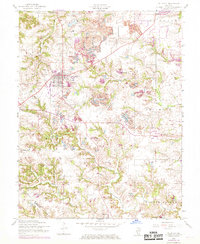
1954 Map of Millstadt
USGS Topo · Published 1969About this map
Millstadt serves as the primary hub of this St. Clair County landscape, which transitions from organized town grids to active industrial zones and quiet rural crossroads. The topography is shaped by extensive coal extraction, with several Strip Mine operations scattered throughout the Smith Ton and Stookey townships. Local transit history is visible in the prominent Old Railroad Grade running west of the main settlement. Community life in the mid-20th century centered on landmarks like Concordia Ch and rural education centers such as Mt Evergreen Sch. Further south, the terrain follows the winding paths of Richland Creek and Prairie du Long Creek, reaching the small clusters of Bohleysville and Floraville. This map provides a detailed look at the era's land use, where agricultural drainage meets the expanding footprint of surface mining.
Find a feature on this map
27 named features on this map. Tap any name to fly to it.
Don’t see what you’re looking for? This feature index may not catch every label — zoom into the map to look around manually.
Map Details
Editions of this 1954 Millstadt Map
3 editions found
Other maps of this area

1888 · St. Louis
USGS Topo · 1:62,500

1907 · Belleville
USGS Topo · 1:62,500

1910 · Waterloo
USGS Topo · 1:62,500

1912 · New Athens
USGS Topo · 1:62,500

1913 · Waterloo
USGS Topo · 1:62,500

1931 · French Village
USGS Topo · 1:24,000

1933 · Cahokia
USGS Topo · 1:24,000

1934 · Cahokia
USGS Topo · 1:24,000

1935 · French Village
USGS Topo · 1:24,000

1937 · O'Fallon
USGS Topo · 1:24,000