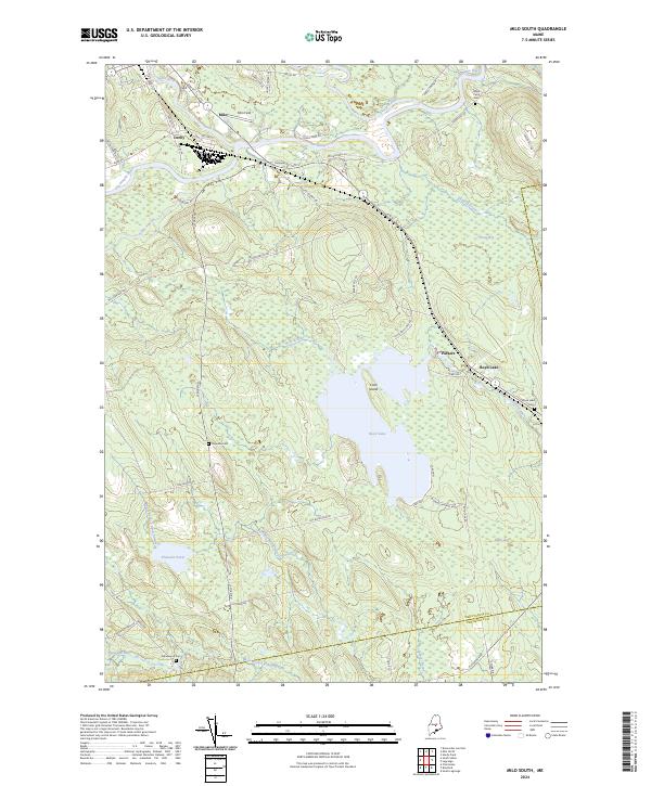
2024 Map of Milo South
USGS Topo · Published 2024About this map
The Piscataquis River and Pleasant River converge near the rail-oriented community of Derby and the town of Milo in this contemporary overview of south-central Maine. The landscape is defined by its complex hydrology, where the Sebec River joins the larger flows amidst a network of low-lying wetlands like Freese Bog and Black Bog. To the south, Boyd Lake serves as a prominent landmark, featuring Cook Island and feeding into Dead Stream. For family historians, the presence of several established burial grounds including Upper Ferry Cem, Boyd Lake Cem, and Orneville Cem provides critical points of reference for local genealogy. The transition from the settled streets of Milo to the surrounding timberlands and bogs illustrates the enduring relationship between these riverside communities and the wooded interior of Piscataquis County.
Find a feature on this map
62 named features on this map. Tap any name to fly to it.
Don’t see what you’re looking for? This feature index may not catch every label — zoom into the map to look around manually.
Map Details
Editions of this 2024 Milo South Map
This is the sole edition of this map. No revisions or reprints were ever made.
Other maps of this area

1932 · Dover-Foxcroft
USGS Topo · 1:48,000

1933 · Boyd Lake
USGS Topo · 1:62,500

1935 · Dover-Foxcroft
USGS Topo · 1:62,500

1940 · Sebec
USGS Topo · 1:48,000

1943 · Sebec
USGS Topo · 1:62,500

1947 · Schoodic
USGS Topo · 1:62,500

1949 · Schoodic
USGS Topo · 1:62,500

1951 · Boyd Lake
USGS Topo · 1:50,000

1954 · Millinocket
USGS Topo · 1:250,000

1955 · Boyd Lake
USGS Topo · 1:62,500