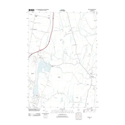
2012 Map of Milton
USGS Topo · Published 2012About this map
The Lamoille River cuts through this Vermont landscape, connecting the village of Fairfax to the waters of Arrowhead Mountain Lake. This 2012 survey illustrates a region defined by its dispersed rural settlements, including Georgia Center, East Georgia, Oakland, and Hubbard Corner. Significant for genealogists and local historians, the area is dotted with numerous family-named burial grounds such as Hubbard Cem, Fairchild Cem, and Loomis Cem, alongside the historic Lower Covered Bridge near the eastern bend of the river. The terrain transitions from the heights of Georgia Mountain and Arrowhead Mountain down toward Milton Pond and the branching waters of Malletts Cr. Local recreation is anchored by Homestead Campgrounds and Maple Grove Campground, while the town of Milton serves as the southern hub for this network of backroads and brookside hamlets.
Find a feature on this map
132 named features on this map. Tap any name to fly to it.
Don’t see what you’re looking for? This feature index may not catch every label — zoom into the map to look around manually.
Map Details
Editions of this 2012 Milton Map
This is the sole edition of this map. No revisions or reprints were ever made.
Other maps of this area

1913 · Milton
USGS Topo · 1:48,000

1914 · St. Albans
USGS Topo · 1:48,000

1915 · Milton
USGS Topo · 1:62,500

1916 · St. Albans
USGS Topo · 1:62,500

1920 · Franklin Pond
USGS Topo · 1:62,500

1922 · Enosburg Falls
USGS Topo · 1:48,000

1924 · Enosburg Falls
USGS Topo · 1:62,500

1925 · Mount Mansfield
USGS Topo · 1:48,000

1927 · Mount Mansfield
USGS Topo · 1:62,500

1943 · St. Albans
USGS Topo · 1:62,500