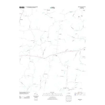
2013 Map of Milton
USGS Topo · Published 2013About this map
Milton serves as the central hub for this rural Tennessee landscape, where a network of country roads connects family-held lands and agricultural operations. To the south, the Stonewall Airpark provides a distinct aviation landmark among the rolling terrain, while Green Valley Dairy Farms highlights the region's active dairy industry. The topography is defined by the headwaters of the E Fork Stones River and numerous tributaries such as Bradley Creek and Dry Fork. Settlements like Cainsville, Greenvale, and Porterfield anchor the quadrangle, which is also shaped by several prominent rises in the northeast including Lawrence Knob, Turney Knob, and Fisher Knob. The map reveals a persistent rural character, evidenced by the density of named hollows and creek branches that have historically dictated the placement of homesteads and small communities.
Find a feature on this map
78 named features on this map. Tap any name to fly to it.
Don’t see what you’re looking for? This feature index may not catch every label — zoom into the map to look around manually.
Map Details
Editions of this 2013 Milton Map
This is the sole edition of this map. No revisions or reprints were ever made.
Other maps of this area

1908 · Woodbury
USGS Topo · 1:62,500

1916 · Murfreesboro
USGS Topo · 1:62,500

1942 · Statesville
USGS Topo · 1:100,000

1942 · Lebanon
USGS Topo · 1:100,000

1956 · Vine
USGS Topo · 1:24,000

1956 · Dillton
USGS Topo · 1:24,000

1956 · Columbia
USGS Topo · 1:250,000

1956 · Nashville
USGS Topo · 1:250,000
1957 · Lascassas
USGS Topo · 1:24,000

1958 · Watertown
USGS Topo · 1:24,000