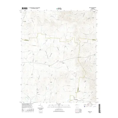
2016 Map of Milton
USGS Topo · Published 2016About this map
The community of Milton serves as a central hub on this 2016 survey, situated where the borders of Wilson, Rutherford, and Cannon Counties converge. The landscape is defined by the winding Bradley Creek and the East Fork Stones River, with the terrain rising toward the northeast into prominent heights like Lawrence Knob and Turney Knob. This area maintains a strong connection to its 19th-century settlement patterns, evidenced by a dense concentration of family and community burial grounds, including the Bradleys Creek Cem, Rucker Goodloe Cem, and the Floyd-Alexander Cem.
Find a feature on this map
88 named features on this map. Tap any name to fly to it.
Don’t see what you’re looking for? This feature index may not catch every label — zoom into the map to look around manually.
Map Details
Editions of this 2016 Milton Map
This is the sole edition of this map. No revisions or reprints were ever made.
Other maps of this area

1908 · Woodbury
USGS Topo · 1:62,500

1916 · Murfreesboro
USGS Topo · 1:62,500

1942 · Statesville
USGS Topo · 1:100,000

1942 · Lebanon
USGS Topo · 1:100,000

1956 · Vine
USGS Topo · 1:24,000

1956 · Dillton
USGS Topo · 1:24,000

1956 · Columbia
USGS Topo · 1:250,000

1956 · Nashville
USGS Topo · 1:250,000
1957 · Lascassas
USGS Topo · 1:24,000

1958 · Watertown
USGS Topo · 1:24,000