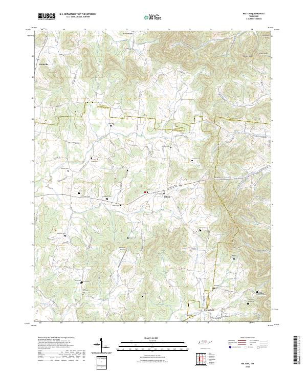
2022 Map of Milton
USGS Topo · Published 2022About this map
Milton sits at the convergence of three Tennessee counties, serving as a focal point for a landscape defined by the drainage basins of the East Fork Stones River and Bradley Creek. This survey details the rural character of the region as it appeared in the 2020s, illustrating a complex web of family-named burial grounds and historical property markers. Numerous small cemeteries, such as the Rucker Goodloe Cem and Floyd - Alexander Cem, are scattered among the ridges and hollows, providing significant data for genealogical research.
Find a feature on this map
95 named features on this map. Tap any name to fly to it.
Don’t see what you’re looking for? This feature index may not catch every label — zoom into the map to look around manually.
Map Details
Editions of this 2022 Milton Map
This is the sole edition of this map. No revisions or reprints were ever made.
Other maps of this area

1908 · Woodbury
USGS Topo · 1:62,500

1916 · Murfreesboro
USGS Topo · 1:62,500

1942 · Statesville
USGS Topo · 1:100,000

1942 · Lebanon
USGS Topo · 1:100,000

1956 · Vine
USGS Topo · 1:24,000

1956 · Dillton
USGS Topo · 1:24,000

1956 · Columbia
USGS Topo · 1:250,000

1956 · Nashville
USGS Topo · 1:250,000
1957 · Lascassas
USGS Topo · 1:24,000

1958 · Watertown
USGS Topo · 1:24,000