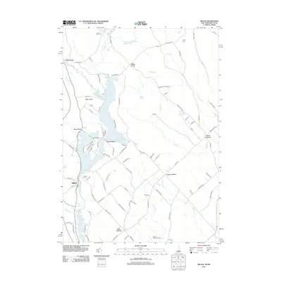
2012 Map of Milton
USGS Topo · Published 2012About this map
The Salmon Falls River serves as the geographic and historical spine of this borderland area, where New Hampshire and Maine meet. In 2012, the landscape is defined by the expansive Milton Three Ponds and the cluster of settlements that have grown along their western shores, including Milton, Milton Ridge, and Fernald Shore. Local history and genealogy are preserved at Prospect Hill Cem and Milton Mills Cem, while smaller crossroad settlements like Laskey Corner and Miller Corner mark the intersections of rural life. To the east in Maine, the terrain transitions into a patchwork of hills and waterways, including Hurd Hill and the winding Keay Brook. The inclusion of the Skydive Lebanon Airport reflects the more contemporary recreational uses of the land amidst the traditional network of woodlots and ponds.
Find a feature on this map
96 named features on this map. Tap any name to fly to it.
Don’t see what you’re looking for? This feature index may not catch every label — zoom into the map to look around manually.
Map Details
Editions of this 2012 Milton Map
This is the sole edition of this map. No revisions or reprints were ever made.
Other maps of this area

1891 · Berwick
USGS Topo · 1:62,500

1891 · Newfield
USGS Topo · 1:62,500

1893 · Berwick
USGS Topo · 1:62,500

1893 · Newfield
USGS Topo · 1:62,500

1919 · Alton
USGS Topo · 1:62,500

1928 · Wolfeboro
USGS Topo · 1:62,500

1933 · Berwick
USGS Topo · 1:48,000

1933 · Newfield
USGS Topo · 1:48,000

1937 · Newfield
USGS Topo · 1:62,500

1937 · Berwick
USGS Topo · 1:62,500