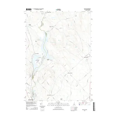
2015 Map of Milton
USGS Topo · Published 2015About this map
The Salmon Falls River serves as the primary geographic and political divider in this region, marking the boundary between New Hampshire and Maine, as well as Strafford and York counties. The landscape is defined by its significant water bodies, including Milton Pond, the Mousam River Reservoir, and the northern reaches of Spaulding Pond. Settlements like Milton Mills, North Lebanon, and Center Lebanon are scattered across the terrain, connected by a network of rural roads such as Milton Mills Rd and Ridgewood Dr. Genealogists will find interest in several local burying grounds, including Milton Mills Cem, Forest Grove Cem, and Prospect Hill Cem. The southern portion of the area transitions toward the outskirts of Rochester, while unique local landmarks like the Skydive Lebanon Airport and elevations like Hurd Hill provide clear reference points for those studying the regional topography.
Find a feature on this map
91 named features on this map. Tap any name to fly to it.
Don’t see what you’re looking for? This feature index may not catch every label — zoom into the map to look around manually.
Map Details
Editions of this 2015 Milton Map
This is the sole edition of this map. No revisions or reprints were ever made.
Other maps of this area

1891 · Berwick
USGS Topo · 1:62,500

1891 · Newfield
USGS Topo · 1:62,500

1893 · Berwick
USGS Topo · 1:62,500

1893 · Newfield
USGS Topo · 1:62,500

1919 · Alton
USGS Topo · 1:62,500

1928 · Wolfeboro
USGS Topo · 1:62,500

1933 · Berwick
USGS Topo · 1:48,000

1933 · Newfield
USGS Topo · 1:48,000

1937 · Newfield
USGS Topo · 1:62,500

1937 · Berwick
USGS Topo · 1:62,500