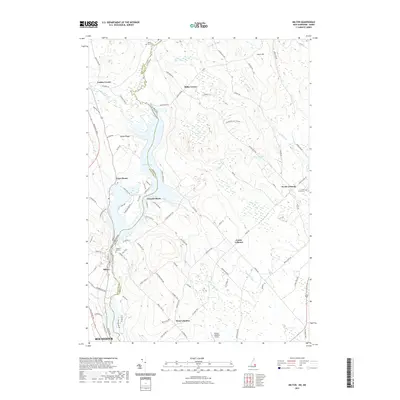
2021 Map of Milton
USGS Topo · Published 2021About this map
Milton Pond and the Salmon Falls River form the border between Strafford County, New Hampshire, and York County, Maine, in this detailed study of the borderlands. The terrain is defined by low-lying wetlands and significant elevations like Milton Ridge and Hurd Hill. Small settlements and named crossroads such as Laskey Corner, Miller Corner, and Town House illustrate the rural residential character of the region. Local history is anchored by several burial grounds, including Milton Mills Cem, Prospect Hill Cem, and Forest Grove Cem. The landscape also features modern utility and transportation infrastructure, including the Spaulding Tpke and the Skydive Lebanon Airport, while maintaining large tracts of marshland and wooded areas near Black Pond and Nisbitt Pond.
Find a feature on this map
97 named features on this map. Tap any name to fly to it.
Don’t see what you’re looking for? This feature index may not catch every label — zoom into the map to look around manually.
Map Details
Editions of this 2021 Milton Map
This is the sole edition of this map. No revisions or reprints were ever made.
Other maps of this area

1891 · Berwick
USGS Topo · 1:62,500

1891 · Newfield
USGS Topo · 1:62,500

1893 · Berwick
USGS Topo · 1:62,500

1893 · Newfield
USGS Topo · 1:62,500

1919 · Alton
USGS Topo · 1:62,500

1928 · Wolfeboro
USGS Topo · 1:62,500

1933 · Berwick
USGS Topo · 1:48,000

1933 · Newfield
USGS Topo · 1:48,000

1937 · Newfield
USGS Topo · 1:62,500

1937 · Berwick
USGS Topo · 1:62,500