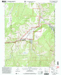
2001 Map of Mineral Mountain
USGS Topo · Published 2004About this map
Cebolla Creek winds through this high-altitude landscape in the southern Rockies, serving as a primary drainage for the surrounding Powderhorn Wilderness and La Garita Wilderness. The area is defined by massive federal and state land holdings, including the Gunnison National Forest and the Cebolla State Wildlife Area. Small settlements like Cathedral and Corral appear along the Los Pinos-Cebolla Road, reflecting the isolated ranching and outpost character of Hinsdale County at the turn of the 21st century.
Find a feature on this map
36 named features on this map. Tap any name to fly to it.
Don’t see what you’re looking for? This feature index may not catch every label — zoom into the map to look around manually.
Map Details
Editions of this 2001 Mineral Mountain Map
This is the sole edition of this map. No revisions or reprints were ever made.
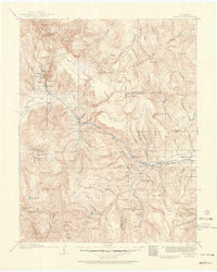
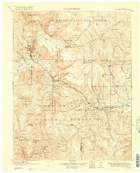
Other maps of this area

1905 · San Cristobal
USGS Topo · 1:125,000

1907 · San Cristobal
USGS Topo · 1:125,000

1908 · Uncompahgre
USGS Topo · 1:125,000

1911 · Uncompahgre
USGS Topo · 1:125,000
1914 · Creede
USGS Topo · 1:125,000
1916 · Creede
USGS Topo · 1:125,000

1945 · Durango
USGS Topo · 1:250,000

1953 · Durango
USGS Topo · 1:250,000

1954 · Durango
USGS Topo · 1:250,000

1956 · Montrose
USGS Topo · 1:250,000