2023 Map of Minersville
USGS Topo · Published 2023About this map
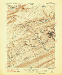
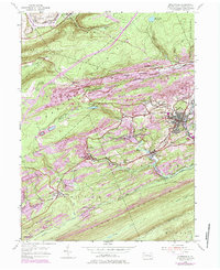
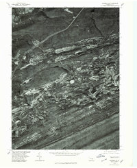
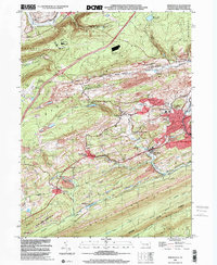
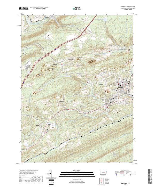
Minersville serves as the focal point of this Schuylkill County landscape, where the concentrated cluster of religious and ethnic cemeteries—such as Saint Nicholas Ukrainian Catholic Cem and Our Lady of Mount Carmel Cem—points to the deep-rooted mining communities of the anthracite region. The terrain is defined by the heavy ridges of Broad Mountain and Sharp Mountain, which channel the West Branch Schuylkill River and its tributaries through a corridor of industrial history. Smaller settlements like Heckscherville, Branchdale, and Phoenix Park are linked by a network of local routes including Sunbury Rd and Valley Rd. This modern survey documents the contemporary state of the land, from the Gordon Reservoir in the north to the Schuylkill County/Joe Zerbey Airport in the west, illustrating how centuries of coal mining have shaped the drainage and development of the valley.
Find a feature on this map
147 named features on this map. Tap any name to fly to it.
Don’t see what you’re looking for? This feature index may not catch every label — zoom into the map to look around manually.
Map Details
Editions of this 2023 Minersville Map
This is the sole edition of this map. No revisions or reprints were ever made.
Historical Maps of Barry Township Through Time
5 maps found