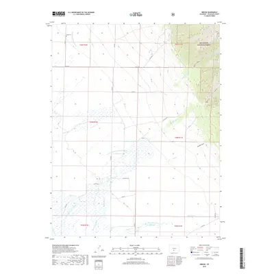
2019 Map of Mirage
USGS Topo · Published 2019About this map
Mirage stands at the western edge of this landscape where the high San Luis Valley floor meets the rising slopes of the Sangre de Cristo Mountains. The settlement is anchored by the Mirage Cem, providing a focal point for genealogical interest in Saguache County. The terrain transition is abrupt, moving from the open flats of the valley into the densely contoured heights of the Rio Grande National Forest.
Find a feature on this map
44 named features on this map. Tap any name to fly to it.
Don’t see what you’re looking for? This feature index may not catch every label — zoom into the map to look around manually.
Map Details
Editions of this 2019 Mirage Map
This is the sole edition of this map. No revisions or reprints were ever made.
Other maps of this area

1950 · Valley View Hot Springs
USGS Topo · 1:24,000

1954 · Trinidad
USGS Topo · 1:250,000

1954 · Pueblo
USGS Topo · 1:250,000

1955 · Trinidad
USGS Topo · 1:250,000

1957 · Pueblo
USGS Topo · 1:250,000

1958 · Trinidad
USGS Topo · 1:250,000

1958 · Pueblo
USGS Topo · 1:250,000

1959 · Trinidad
USGS Topo · 1:250,000

1959 · Electric Peak
USGS Topo · 1:62,500

1962 · Pueblo
USGS Topo · 1:250,000