
1960 Map of Mobile
USGS Topo · Published 1960About this map
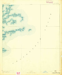
Mobile and New Orleans anchor the eastern and western ends of this 1960 coastal study, which highlights the dense network of maritime and rail infrastructure along the Gulf Coast. The map detail reveals the strategic importance of military installations like Keesler AFB in Biloxi and Brookley AFB near the Mobile Bay shoreline. Between these hubs, the landscape is defined by the Mississippi Sound and the barrier islands including Cat Island, Ship Island, and Horn Island. Inland, the DeSoto National Forest dominates the interior, while the winding courses of the Pearl River, Pascagoula River, and Chickasawhay River illustrate the natural drainage patterns that shaped early settlement. Railroad enthusiasts can trace the routes of the Louisville & Nashville and the Gulf Mobile & Ohio, which linked coastal ports like Pascagoula and Gulfport to the timber and agricultural lands of the interior.
Find a feature on this map
165 named features on this map. Tap any name to fly to it.
Don’t see what you’re looking for? This feature index may not catch every label — zoom into the map to look around manually.
Map Details
Editions of this 1960 Mobile Map
This is the sole edition of this map. No revisions or reprints were ever made.
Other maps of this area

1891 · Spanish Fort
USGS Topo · 1:62,500

1891 · New Orleans
USGS Topo · 1:62,500

1892 · Chef Menteur
USGS Topo · 1:62,500

1892 · St. Bernard
USGS Topo · 1:62,500

1893 · Cat Island
USGS Topo · 1:62,500

1893 · Rigolets
USGS Topo · 1:62,500
1893 · Chandeleur
USGS Topo · 1:62,500

1893 · Shell Beach
USGS Topo · 1:62,500

1893 · Toulme
USGS Topo · 1:62,500

1895 · Bodreau
USGS Topo · 1:62,500