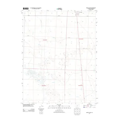
2013 Map of Moffat South
USGS Topo · Published 2013About this map
Moffat sits at the northern edge of this high-altitude San Luis Valley landscape, serving as a gateway to the intricate drainage network of the region. The map reveals a complex system of seasonal watercourses and depressions, including the Mishok Lakes and the branching paths of Saguache Cr and La Garita Cr. This 2013 survey illustrates the strictly rectilinear grid of county roads, such as Co Road T and Co Road R, which impose a human order over the arid terrain and the winding beds of Ball Arroyo and Werner Arroyo. The southeastern corner is defined by the course of San Luis Cr, highlighting the importance of every water source in this part of Saguache County. The street plan of the town itself is documented through named thoroughfares like Garfield Ave and Lincoln Ave, which align with the historical north-south corridor of Co-17.
Find a feature on this map
22 named features on this map. Tap any name to fly to it.
Don’t see what you’re looking for? This feature index may not catch every label — zoom into the map to look around manually.
Map Details
Editions of this 2013 Moffat South Map
This is the sole edition of this map. No revisions or reprints were ever made.
Other maps of this area

1915 · Del Norte
USGS Topo · 1:125,000

1917 · Del Norte
USGS Topo · 1:125,000

1945 · Durango
USGS Topo · 1:250,000

1953 · Durango
USGS Topo · 1:250,000

1954 · Durango
USGS Topo · 1:250,000

1954 · Trinidad
USGS Topo · 1:250,000

1954 · Pueblo
USGS Topo · 1:250,000

1955 · Trinidad
USGS Topo · 1:250,000

1956 · Montrose
USGS Topo · 1:250,000

1957 · Pueblo
USGS Topo · 1:250,000