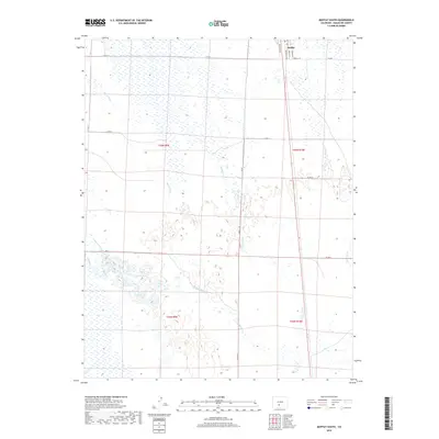
2019 Map of Moffat South
USGS Topo · Published 2019About this map
Moffat sits at the northern edge of this high-altitude drainage basin, serving as a hub for a network of rural routes including Russell St, Broadway, and Lincoln St. The landscape is defined by the ephemeral flow of several high-plains watercourses that traverse the valley floor, most notably Ball Arroyo and Werner Arroyo, which illustrate the complex hydrology of this part of Saguache County. Moving south through the survey area, the terrain is marked by the meandering paths of Saguache Cr, San Luis Cr, and La Garita Cr. These creeks, along with Russell Cr, suggest a seasonally varied environment where water management and ranching roads like Co Rd N and Co Rd Q dictate the pattern of human activity and land division across the T43N and T42N townships.
Find a feature on this map
24 named features on this map. Tap any name to fly to it.
Don’t see what you’re looking for? This feature index may not catch every label — zoom into the map to look around manually.
Map Details
Editions of this 2019 Moffat South Map
This is the sole edition of this map. No revisions or reprints were ever made.
Other maps of this area

1915 · Del Norte
USGS Topo · 1:125,000

1917 · Del Norte
USGS Topo · 1:125,000

1945 · Durango
USGS Topo · 1:250,000

1953 · Durango
USGS Topo · 1:250,000

1954 · Durango
USGS Topo · 1:250,000

1954 · Trinidad
USGS Topo · 1:250,000

1954 · Pueblo
USGS Topo · 1:250,000

1955 · Trinidad
USGS Topo · 1:250,000

1956 · Montrose
USGS Topo · 1:250,000

1957 · Pueblo
USGS Topo · 1:250,000