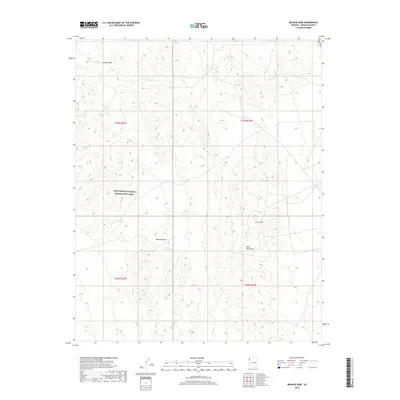
2018 Map of Mohave Mine
USGS Topo · Published 2018About this map
Mohave Mine sits within the eastern reaches of the Black Mountains, marking a point of historic extraction in this corner of the Mojave Desert. This 2018 survey illustrates a landscape defined by sharp elevation changes and dry drainage systems, most notably Jumbo Wash, which cuts across the northern terrain. The northwestern portion of the quadrangle is occupied by the Lake Mead National Recreation Area, reflecting the transition from desert mining interests to federally protected conservation and recreation lands. The map detail highlights a network of local roads and 4WD tracks that navigate the complex topography, providing a precise look at how the land is accessed in modern times while still preserving the footprints of its industrial past.
Find a feature on this map
9 named features on this map. Tap any name to fly to it.
Don’t see what you’re looking for? This feature index may not catch every label — zoom into the map to look around manually.
Map Details
Editions of this 2018 Mohave Mine Map
This is the sole edition of this map. No revisions or reprints were ever made.
Other maps of this area

1886 · Camp Mohave
USGS Topo · 1:250,000

1892 · Camp Mohave
USGS Topo · 1:250,000

1926 · Nelson
USGS Topo · 1:96,000

1942 · Camp Mohave
USGS Topo · 1:250,000

1947 · Kingman
USGS Topo · 1:250,000

1948 · Kingman
USGS Topo · 1:250,000

1954 · Kingman
USGS Topo · 1:250,000

1955 · Kingman
USGS Topo · 1:250,000

1958 · Kingman
USGS Topo · 1:250,000
1959 · Willow Beach
USGS Topo · 1:24,000