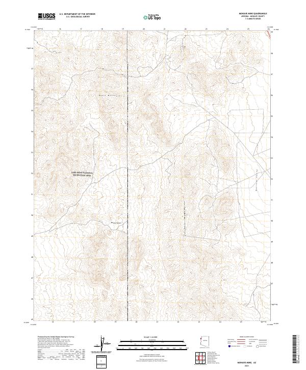
2021 Map of Mohave Mine
USGS Topo · Published 2021About this map
The Black Mountains dominate this high-desert landscape in northwestern Arizona, marking a sharp topographic transition within the Lake Mead National Recreation Area. These peaks overlook the broad Detrital Valley to the east, illustrating a classic basin-and-range geomorphology characteristic of the eastern Mojave Desert. The map details the intricate drainage patterns and ridge lines that define this arid environment, revealing the complex relief and dry wash systems that run toward the valley floor. Large tracts of federally managed land are organized by the Public Land Survey System, as indicated by the township and range boundaries including t27n r22w and t27n r21w. This survey is a focused study of a remote corner of Mohave County, where the elevation drops from the rugged mountain crests down into the alluvial plains.
Find a feature on this map
8 named features on this map. Tap any name to fly to it.
Don’t see what you’re looking for? This feature index may not catch every label — zoom into the map to look around manually.
Map Details
Editions of this 2021 Mohave Mine Map
This is the sole edition of this map. No revisions or reprints were ever made.
Other maps of this area

1886 · Camp Mohave
USGS Topo · 1:250,000

1892 · Camp Mohave
USGS Topo · 1:250,000

1926 · Nelson
USGS Topo · 1:96,000

1942 · Camp Mohave
USGS Topo · 1:250,000

1947 · Kingman
USGS Topo · 1:250,000

1948 · Kingman
USGS Topo · 1:250,000

1954 · Kingman
USGS Topo · 1:250,000

1955 · Kingman
USGS Topo · 1:250,000

1958 · Kingman
USGS Topo · 1:250,000
1959 · Willow Beach
USGS Topo · 1:24,000