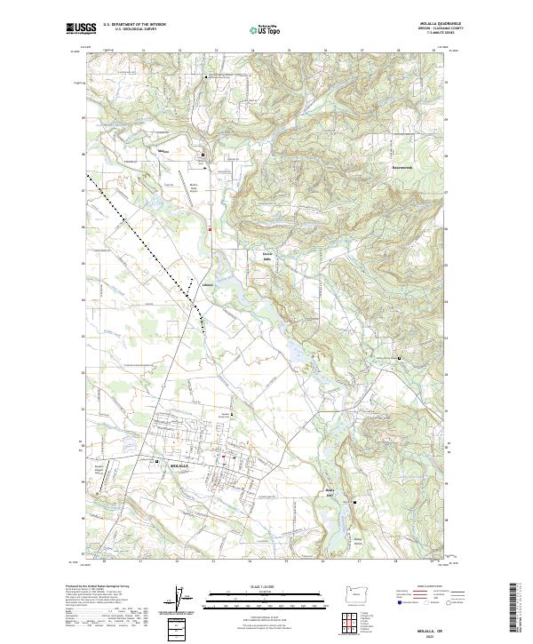
2023 Map of Molalla
USGS Topo · Published 2023About this map
Molalla and its surrounding Clackamas County hinterlands are defined by a network of creek drainages and small agricultural settlements at the edge of the Cascade foothills. The topography is shaped by the Molalla River and its numerous tributaries, including Milk Creek, Beaver Creek, and Gribble Creek, which historically supported local timber and milling operations. The map documents several established communities such as Mulino, Liberal, and Beavercreek, while smaller locales like Union Mills, Shady Dell, and Dickey Prairie illustrate the rural density of the area. For genealogists, the map is particularly detailed, showing several private and institutional burial grounds including the Holy New Martyrs-Russian Orthodox Church Cem, Howard Family Cem, Sanders Family Cem, and the Cutting Family Graves. Transportation infrastructure like the Mulino State Airport serves as a modern landmark amidst these long-settled farmsteads and timberlands.
Find a feature on this map
143 named features on this map. Tap any name to fly to it.
Don’t see what you’re looking for? This feature index may not catch every label — zoom into the map to look around manually.
Map Details
Editions of this 2023 Molalla Map
This is the sole edition of this map. No revisions or reprints were ever made.
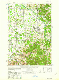
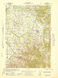
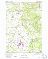
Historical Maps of Molalla Through Time
4 maps found