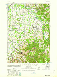
1939 Map of Molalla
USGS Topo · Published 1962About this map
The Molalla River corridor and its surrounding agricultural prairies define this landscape at the end of the 1930s. Centered on the town of Molalla, the area shows a dense network of early 20th-century rural infrastructure, including the Southern Pacific railroad line connecting the timber and farming communities of Mulino, Liberal, and Union Mills. The map reveals the distribution of early educational life through numerous local schoolhouses such as Whiskey Hill Sch, Dryland Sch, and School Ninety One.
Find a feature on this map
56 named features on this map. Tap any name to fly to it.
Don’t see what you’re looking for? This feature index may not catch every label — zoom into the map to look around manually.
Map Details
Editions of this 1939 Molalla Map
2 editions found
Other maps of this area

1911 · Boring
USGS Topo · 1:48,000

1914 · Boring
USGS Topo · 1:62,500

1914 · Oregon City
USGS Topo · 1:62,500

1916 · Tualatin
USGS Topo · 1:62,500

1916 · Estacada
USGS Topo · 1:125,000

1923 · Mount Angel
USGS Topo · 1:62,500

1925 · Stayton
USGS Topo · 1:62,500

1929 · Mill City
USGS Topo · 1:125,000

1939 · Molalla
USGS Topo · 1:62,500

1939 · Oregon City
USGS Topo · 1:62,500