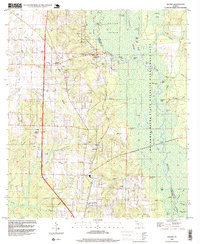
1994 Map of Molino
USGS Topo · Published 1999About this map
The Escambia River floodplain dominates this portion of the Florida Panhandle, creating a complex wetland environment of islands and oxbow lakes. Settlements such as Molino, Quintette, and Cottage Hill are situated on the higher ground to the west, away from the seasonal inundation of the Escambia River State Wildlife Management Area. The landscape is marked by numerous small tributaries like Pine Barren Creek and Jacks Branch, which cut through the undulating terrain toward the river basin.
Find a feature on this map
64 named features on this map. Tap any name to fly to it.
Don’t see what you’re looking for? This feature index may not catch every label — zoom into the map to look around manually.
Map Details
Editions of this 1994 Molino Map
This is the sole edition of this map. No revisions or reprints were ever made.
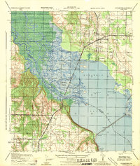
Other maps of this area

1920 · Milton
USGS Topo · 1:62,500

1921 · Muscogee
USGS Topo · 1:62,500

1941 · Muscogee
USGS Topo · 1:62,500

1941 · Milton
USGS Topo · 1:62,500

1941 · Century
USGS Topo · 1:62,500

1943 · Muscogee
USGS Topo · 1:62,500

1943 · Century
USGS Topo · 1:62,500

1943 · Milton
USGS Topo · 1:62,500

1943 · Jay
USGS Topo · 1:62,500
1944 · Floridatown
USGS Topo · 1:25,000