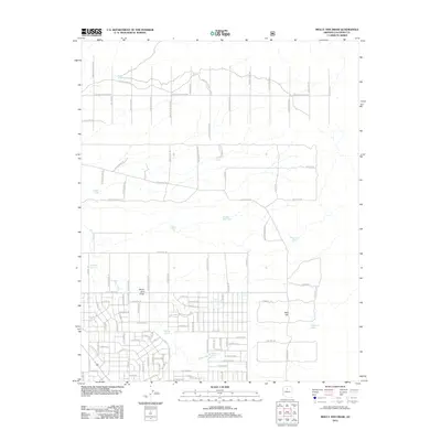
2012 Map of Molly Ann Draw
USGS Topo · Published 2012About this map
Molly Ann Draw and the surrounding drainage of Miller Wash define this rural Coconino County landscape during the early twenty-first century. The area is characterized by a sophisticated network of water catchment features, essential for life and livestock in this high-desert environment. Numerous named reservoirs, including Ten Tank, Steel Rim Tank, and Maverick Tank, are situated along the natural draws and drainages. A distinctive grid of residential and ranch roads, such as E Woodland Ranch Rd and Indian Meadows Rd, reveals a pattern of dispersed settlement and land use. Local landmarks like Red Hill and Watchtower Pass provide topographical orientation amidst a complex system of local ways including Mohave Trl and S Rim Ranch Rd. The presence of features like Oakie Hole and Cistern Tank reflects a long history of managing limited water resources on these high plateaus.
Find a feature on this map
110 named features on this map. Tap any name to fly to it.
Don’t see what you’re looking for? This feature index may not catch every label — zoom into the map to look around manually.
Map Details
Editions of this 2012 Molly Ann Draw Map
This is the sole edition of this map. No revisions or reprints were ever made.
Other maps of this area

1886 · San Francisco Mtns
USGS Topo · 1:250,000

1886 · Chino
USGS Topo · 1:250,000

1891 · San Francisco Mtns
USGS Topo · 1:250,000

1891 · Chino
USGS Topo · 1:250,000

1894 · San Francisco Mtns
USGS Topo · 1:250,000

1899 · San Francisco Mtns
USGS Topo · 1:250,000

1947 · Flagstaff
USGS Topo · 1:250,000

1948 · Williams
USGS Topo · 1:250,000

1954 · Flagstaff
USGS Topo · 1:250,000

1954 · Williams
USGS Topo · 1:250,000