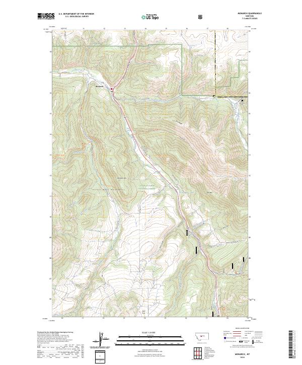
2024 Map of Monarch
USGS Topo · Published 2024About this map
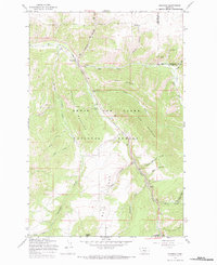
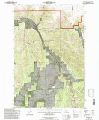
Monarch is established along the banks of Belt Creek, serving as a central point for this high-elevation terrain within the Lewis & Clark National Forest. The landscape is defined by the sharp descent of Monarch Canyon and the convergence of several drainages, including Dry Fork Belt Creek and Tillinghast Creek. These waterways and their associated coulees, such as Currie Coulee and Bear Coulee, historically dictated the movement of travel and settlement through the Little Belt Mountains.
Find a feature on this map
57 named features on this map. Tap any name to fly to it.
Don’t see what you’re looking for? This feature index may not catch every label — zoom into the map to look around manually.
Map Details
Editions of this 2024 Monarch Map
This is the sole edition of this map. No revisions or reprints were ever made.
Historical Maps of Monarch Through Time
3 maps found