2022 Map of Mondovi
USGS Topo · Published 2022About this map
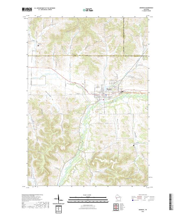
The city of Mondovi serves as the central hub of this Wisconsin river valley landscape, situated where Brownlee Cr and several smaller tributaries converge near Mirror Lake. The area's settlement pattern is defined by a series of narrow, distinct valleys, including German Valley, Halverson Valley, Thompson Valley, and Armour Valley, which are separated by prominent ridgelines like Bennett Ridge. This topography has historically funneled agriculture and local infrastructure into the low-lying draws, a legacy visible in the distribution of family and community landmarks. Researchers will find several burial grounds marking the history of the town's early residents, including Riverside City Cem, Sacred Heart Cem, Riverside Lutheran Cem, and the more distant German Valley Cem and Naples Cem. The map reveals the intricate border regions of Buffalo, Pepin, and Eau Claire counties, where the land transitions from the Buffalo River floodplain to the high, road-traced crests above the valleys.
Find a feature on this map
95 named features on this map. Tap any name to fly to it.
Don’t see what you’re looking for? This feature index may not catch every label — zoom into the map to look around manually.
Map Details
Editions of this 2022 Mondovi Map
This is the sole edition of this map. No revisions or reprints were ever made.
Historical Maps of Drammen Through Time
3 maps found