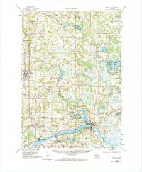
1961 Map of Montello
USGS Topo · Published 1972About this map
Montello serves as a primary hub where the Montello River meets the expansive Buffalo Lake, a geography defined by post-glacial wetlands and interconnected waterways. The 1961 landscape reveals a region balancing agricultural drainage with conservation, most notably at the Germania Marsh Wildlife Area and around smaller settlements like Harrisville and Germania. Traces of earlier transit and industry are scattered throughout, from the Old Stage Road cutting through the western townships to the Charcoal Ovens located north of Harris Pond. The map is particularly detailed regarding local landmarks for genealogists, including numerous rural burial grounds such as Newton Ch Cem, Krentz Cem, and the St John the Baptist Cem. From the mills and Gravel Pits to the isolated Stone Ch, the survey illustrates a mid-century Wisconsin landscape of small-town centers and productive wetlands.
Find a feature on this map
81 named features on this map. Tap any name to fly to it.
Don’t see what you’re looking for? This feature index may not catch every label — zoom into the map to look around manually.
Map Details
Editions of this 1961 Montello Map
2 editions found

Other maps of this area

1902 · Portage
USGS Topo · 1:62,500

1902 · Briggsville
USGS Topo · 1:62,500

1915 · Neshkoro
USGS Topo · 1:48,000

1918 · Neshkoro
USGS Topo · 1:62,500

1955 · Randolph
USGS Topo · 1:62,500

1955 · Green Bay
USGS Topo · 1:250,000

1957 · Madison
USGS Topo · 1:250,000

1958 · Briggsville
USGS Topo · 1:62,500

1958 · Coloma
USGS Topo · 1:48,000

1959 · Wautoma
USGS Topo · 1:48,000