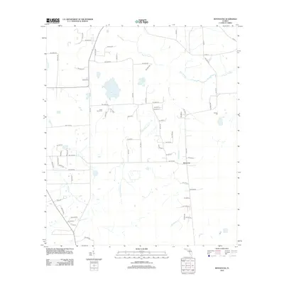
2012 Map of Monteocha
USGS Topo · Published 2012About this map
Monteocha stands as a primary point of reference in this North Florida landscape, where the northern border is defined by the winding course of the Santa Fe River. The terrain is characterized by a network of drainage systems including Rocky Cr, Monteoch Cr, and Little Monteocha Cr, which weave between small bodies of water like Sunshine Lake and Trout Pond. For those tracing local heritage, the presence of Rhuda Branch Cem and Freedom Cem provides specific locations for genealogical research. The map reflects a predominantly rural grid of residential avenues and lanes, such as NW 218th Ave and Tree Farm Rd, illustrating the transition from natural wetlands and creek beds to established rural homesteads and agricultural plots during the early 21st century.
Find a feature on this map
43 named features on this map. Tap any name to fly to it.
Don’t see what you’re looking for? This feature index may not catch every label — zoom into the map to look around manually.
Map Details
Editions of this 2012 Monteocha Map
This is the sole edition of this map. No revisions or reprints were ever made.
Other maps of this area

1890 · Arredondo
USGS Topo · 1:62,500

1892 · Arredondo
USGS Topo · 1:62,500

1894 · Arredondo
USGS Topo · 1:62,500

1938 · Hawthorn
USGS Topo · 1:48,000

1941 · Starke
USGS Topo · 1:62,500

1943 · Hawthorn
USGS Topo · 1:62,500

1948 · Starke
USGS Topo · 1:50,000

1949 · Sampson
USGS Topo · 1:24,000

1949 · Waldo
USGS Topo · 1:24,000

1949 · Starke
USGS Topo · 1:62,500