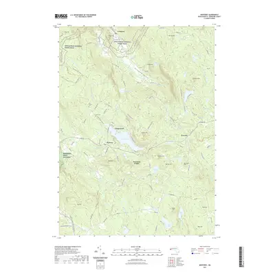
2021 Map of Monterey
USGS Topo · Published 2021About this map
The Appalachian National Scenic Trail winds through the northern elevations of Berkshire County, tracing a path past Sky Hill and Cobble Hill above the Tyringham Valley. This modern survey illustrates the enduring rural character of the region, where historic settlements like Tyringham and Monterey remain centered on high-altitude water bodies and narrow valley floors. The landscape is defined by its complex hydrology, featuring numerous upland wetlands such as Hale Swamp and Angerman Swamp, which feed into the Konkapot River and Buck River systems.
Find a feature on this map
107 named features on this map. Tap any name to fly to it.
Don’t see what you’re looking for? This feature index may not catch every label — zoom into the map to look around manually.
Map Details
Editions of this 2021 Monterey Map
This is the sole edition of this map. No revisions or reprints were ever made.
Other maps of this area

1885 · Sheffield
USGS Topo · 1:62,500

1886 · Becket
USGS Topo · 1:62,500

1888 · Sheffield
USGS Topo · 1:62,500

1888 · Becket
USGS Topo · 1:62,500

1888 · Sandisfield
USGS Topo · 1:62,500

1888 · Pittsfield
USGS Topo · 1:62,500

1890 · Pittsfield
USGS Topo · 1:62,500

1891 · Sheffield
USGS Topo · 1:62,500

1893 · Becket
USGS Topo · 1:62,500

1893 · Sheffield
USGS Topo · 1:62,500