2022 Map of Monterey
USGS Topo · Published 2022About this map
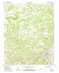
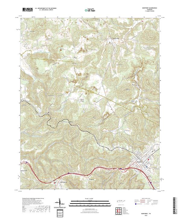
Monterey serves as a prominent highland hub on the Cumberland Plateau, where the headwaters of the Falling Water River and Spring Cr begin their descent through deep hollows. This 2022 survey captures the modern road network around Sand Springs and Pinhook, while preserving the locations of ancestral sites like Welch Memorial Cem and Walker Cem. The terrain is defined by a series of dramatic overlooks and elevated points including Bee Rock and Table Rock Mtn, offering a clear view of the complex topography of Eldridge Cove and Stamps Cove.
Find a feature on this map
120 named features on this map. Tap any name to fly to it.
Don’t see what you’re looking for? This feature index may not catch every label — zoom into the map to look around manually.
Map Details
Editions of this 2022 Monterey Map
This is the sole edition of this map. No revisions or reprints were ever made.