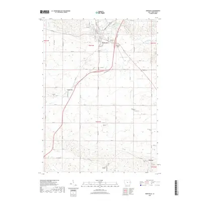
2018 Map of Monticello
USGS Topo · Published 2018About this map
Monticello sits at the confluence of several vital Iowa waterways and transport lines, anchored by the Maquoketa River and its many tributaries. The surrounding landscape is a web of smaller settlements and agricultural crossroads, including Langworthy, Amber, and Edinburg. Local history and genealogy are well-documented here through a dense concentration of burial grounds, ranging from larger sites like Oakwood Cem to smaller family or community plots such as Kiburz Cem, Zimmerman Cem, and Four Horn Cem.
Find a feature on this map
80 named features on this map. Tap any name to fly to it.
Don’t see what you’re looking for? This feature index may not catch every label — zoom into the map to look around manually.
Map Details
Editions of this 2018 Monticello Map
This is the sole edition of this map. No revisions or reprints were ever made.
Other maps of this area

1890 · Anamosa
USGS Topo · 1:62,500

1891 · Monticello
USGS Topo · 1:62,500

1900 · Anamosa
USGS Topo · 1:125,000

1959 · Dubuque
USGS Topo · 1:250,000

1961 · Dubuque
USGS Topo · 1:250,000

1962 · Dubuque
USGS Topo · 1:250,000

1966 · Hopkinton East
USGS Topo · 1:24,000
1966 · Cascade
USGS Topo · 1:24,000
1973 · Anamosa
USGS Topo · 1:24,000
1973 · Hopkinton West
USGS Topo · 1:24,000