2022 Map of Monticello
USGS Topo · Published 2022About this map
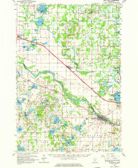
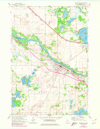
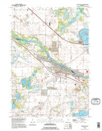
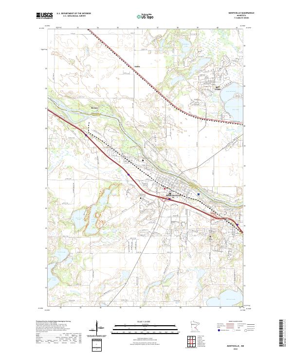
The Mississippi River carves a natural border through this central Minnesota landscape, dividing Sherburne Co and Wright Co. In the southern half, the city of Monticello serves as a primary hub, situated near the banks of the river and home to established landmarks like Saint Henry Catholic Cem and Hillside Cem. To the north, the growing settlements of Becker and Salida sit along the transit corridors, while the expansive waters of Big Lake and Lake Mitchell dominate the northeastern terrain. The area is defined by its dense collection of water bodies, including the Bertram Chain Of Lakes Tri, which provides a complex network of wetlands and shorelines. Genealogists can trace early local history through the presence of several burial grounds, including the Helm Pioneer Cem and Riverside Cem, located along the winding path of the Elk River.
Find a feature on this map
178 named features on this map. Tap any name to fly to it.
Don’t see what you’re looking for? This feature index may not catch every label — zoom into the map to look around manually.
Map Details
Editions of this 2022 Monticello Map
This is the sole edition of this map. No revisions or reprints were ever made.
Historical Maps of Mill Run Through Time
4 maps found