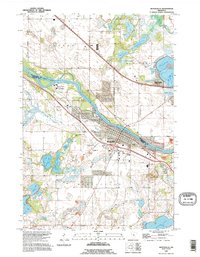
1991 Map of Monticello
USGS Topo · Published 1995About this map
The Mississippi River serves as the dividing line between Wright and Sherburne counties, shaping the growth of Monticello and Big Lake during the early 1990s. This survey, based on imagery from 1991, captures a landscape defined by an intricate network of glacial lakes and wetlands, ranging from the cluster of Hidden Lake, Stroud Lake, and Thompson Lake in the north to the larger Pelican Lake in the south. The transition from industrial activity to community settlement is evident in the presence of numerous Gravel Pits alongside established local landmarks. Genealogists and local historians can locate the Riverside Cem on the riverbank and St Henrys Cem inland, while the era's small-scale infrastructure is recorded through features like Flynn Airport and the Salida rail siding.
Find a feature on this map
35 named features on this map. Tap any name to fly to it.
Don’t see what you’re looking for? This feature index may not catch every label — zoom into the map to look around manually.
Map Details
Editions of this 1991 Monticello Map
This is the sole edition of this map. No revisions or reprints were ever made.
Other maps of this area

1909 · Rockford
USGS Topo · 1:62,500

1953 · Stillwater
USGS Topo · 1:250,000

1955 · Stillwater
USGS Topo · 1:250,000

1958 · Stillwater
USGS Topo · 1:250,000

1958 · Rockford
USGS Topo · 1:62,500

1958 · Buffalo
USGS Topo · 1:62,500

1961 · Clear Lake
USGS Topo · 1:24,000

1961 · Big Lake
USGS Topo · 1:24,000

1961 · Silver Creek
USGS Topo · 1:24,000

1961 · Orrock
USGS Topo · 1:24,000