
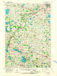
1958 Map of Rockford
USGS Topo · Published 1959About this map
The Crow River meanders through the heart of the landscape, defining the boundaries between Wright and Hennepin counties. This 1950s era survey reveals a region defined by small agricultural settlements and a dense network of country schools and parish churches. The importance of local milling is noted at Berning Mill, while the social fabric of the day is preserved through numerous named sites like Oakdale School, Brookdale School, and St Michael Church.
Find a feature on this map
97 named features on this map. Tap any name to fly to it.
Don’t see what you’re looking for? This feature index may not catch every label — zoom into the map to look around manually.
Map Details
Editions of this 1958 Rockford Map
2 editions found
Other maps of this area

1896 · Minneapolis
USGS Topo · 1:62,500

1901 · Minneapolis
USGS Topo · 1:62,500

1902 · Anoka
USGS Topo · 1:62,500

1905 · Minnetonka
USGS Topo · 1:62,500

1907 · Minnetonka
USGS Topo · 1:62,500

1909 · Rockford
USGS Topo · 1:62,500

1916 · St. Francis
USGS Topo · 1:62,500

1919 · St. Francis
USGS Topo · 1:62,500

1953 · Saint Paul
USGS Topo · 1:250,000

1953 · Stillwater
USGS Topo · 1:250,000