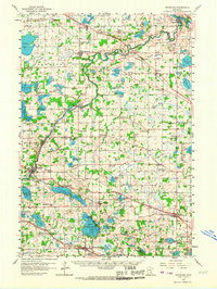
1958 Map of Rockford
USGS Topo · Published 1967About this map
The Crow River snakes through the heart of this landscape, marking the transition between the agricultural expanses of Wright Co and Hennepin Co. In the late 1950s, the region was defined by a dense network of local landmarks, including the Berning Mill on the river and numerous rural educational hubs like Oakdale Sch and North Rockford Sch. The infrastructure of the era is anchored by three major rail lines — the Great Northern, Soo Line, and Northern Pacific — which facilitated the growth of settlements like Maple Plain and Hamel.
Find a feature on this map
107 named features on this map. Tap any name to fly to it.
Don’t see what you’re looking for? This feature index may not catch every label — zoom into the map to look around manually.
Map Details
Editions of this 1958 Rockford Map
2 editions found

Other maps of this area

1896 · Minneapolis
USGS Topo · 1:62,500

1901 · Minneapolis
USGS Topo · 1:62,500

1902 · Anoka
USGS Topo · 1:62,500

1905 · Minnetonka
USGS Topo · 1:62,500

1907 · Minnetonka
USGS Topo · 1:62,500

1909 · Rockford
USGS Topo · 1:62,500

1916 · St. Francis
USGS Topo · 1:62,500

1919 · St. Francis
USGS Topo · 1:62,500

1953 · Saint Paul
USGS Topo · 1:250,000

1953 · Stillwater
USGS Topo · 1:250,000