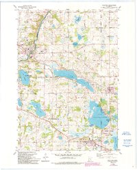
1981 Map of Rockford
USGS Topo · Published 1993About this map
The Crow River winds through the northwest corner of this Hennepin and Wright County landscape, providing a natural boundary for the city of Rockford. During the early 1990s, this region maintained a balance between its growing residential communities like Maple Plain, Loretto, and Greenfield and its significant recreational water bodies. The presence of numerous named lakes, including Lake Sarah and Lake Independence, illustrates the glacial topography central to the area's identity.
Find a feature on this map
55 named features on this map. Tap any name to fly to it.
Don’t see what you’re looking for? This feature index may not catch every label — zoom into the map to look around manually.
Map Details
Editions of this 1981 Rockford Map
2 editions found
Other maps of this area

1905 · Minnetonka
USGS Topo · 1:62,500

1907 · Minnetonka
USGS Topo · 1:62,500

1909 · Rockford
USGS Topo · 1:62,500

1953 · Saint Paul
USGS Topo · 1:250,000

1953 · Stillwater
USGS Topo · 1:250,000

1955 · Stillwater
USGS Topo · 1:250,000

1957 · Waconia
USGS Topo · 1:62,500

1958 · Stillwater
USGS Topo · 1:250,000

1958 · Rockford
USGS Topo · 1:62,500

1958 · Mound
USGS Topo · 1:24,000